Wednesday, October 29, 2014

The White Lady of Wopsy

Overlooking Altoona on Wopsononock Mountain
     To continue with the last couple blog themes of women in white, I felt it was time to write about the White Lady of Wopsy. This legend comes from the Wopsononock, aka Wopsy, mountain west of Altoona, PA. It was one of the first ghost stories I was made aware of growing up. Chances are most people living near Altoona have heard some variation of the tale also. Stories about the White Lady started around the mid 19th century and now a few different versions exist. Sometimes she is also referred to as the White Lady of the Buckhorn, named after an adjacent mountain she is often seen on.

     Wopsononck mountain during the turn of the 19th century was a popular attraction. At the top of the mountain, there once stood a 3 story and 60 room hotel-resort. At the edge of the mountain a 4-story observation tower looked out over the valley of Altoona. The resort also featured its own railroad line that would accommodate picnickers, and sightseers up and down the mountain. In 1903, a forest fire started and took the hotel with other small cottages and vacation homes. A few years after the fire, the railroad and lookout tower were dismantled due to poor funding and lack of interest. Stories of a woman in white really started to spread after the resort was gone. To visit the site of the old resort, follow Wopsy road from Altoona and make a right-hand turn onto Look Out road. The area now is filled with radio and TV towers.
 
     The White Lady of Wopsy is seen as a beautiful young woman wearing a long, white, flowing dress. Sometimes she is seen holding a candle or lantern and always seems to be searching for something. The story goes that her and her newly married husband are traveling the roads on Wopsy mountain by horse and carriage, maybe from the old resort, and are victims of a horrible accident. In a lot of the tales the accident takes place during the colder months. Her husband dies in the wreck and she dies shortly after wandering the mountain due to exposure.

     Other variations explain that their baby was in a carriage with them when they wrecked. Sometimes the baby is said to have been thrown out of the carriage rounding devil's elbow. Devil's elbow is a sharp turn on Wopsononck mountain that has had many accidents throughout the years. Some believe the White Lady died searching for her lost baby in the woods along the Buckhorn and Wopsy mountains and is doomed to keep looking. Yet another story explains the husband was decapitated and the woman died while looking for her husbands head.

     Some speculation is made that the White Lady actually lived on Wopsy mountain. Possibly even an old cottage left from the Resort. Local hunters and thrill seekers have reported finding an old abandon house on the mountain, but no exact location is known. The White Lady is said to haunt the old house as well.

     Many people to this day still claim to see a woman in white roaming the roads along the Buckhorn and Wopsy. People have reported seeing her reflection in their rear-view mirror. Others have admitted to offering a young woman a ride along the mountain roads. She normally smiles and fades away. Reports have taken place at no particular time of the year. The stories are so well known, even a local bar is named “The White Lady Tavern”. So be alert if you are ever traveling the mountains late at night west of Altoona.

Thursday, October 9, 2014

A Ghostly Chase at Coles Station

Coles Water Tank Shelter
      Recently I heard a lead about a ghost that used to terrorize locals near the Coles Station of the East Broad Top Railroad (EBT). Living only about an hour away from parts of the EBT, I never really looked into the history of the rail line or its importance. I was pleased to find out some new history and places to explore, but that is for another blog. 

      With a little research online and at the library, I was able to find an account of a haunting near Coles Station. On a late evening in May of 1906 two men, Luther Chilcote and William Elias, were walking back from a social evening with friends. They choose to walk the easiest route over Coles Summit to their homes. At the summit, near Coles Station of the EBT, they saw in the distance a woman in a white dress. The men began to try to get her attention but she didn't respond to them. The men began to realize she was an apparition as she came closer. The men fired their hand guns in fright as the women drew nearer. After the volley of shots, the apparition started to chase them into the valley. The men reached their home and quickly shut the door behind them. In the days that followed, the men actually reported the incident to the local papers. Thankfully they did to preserve this piece of history.

      Coles Station has sadly razed for many years now and can be found as a rectangular foundation being reclaimed by nature. However, the Coles Water Tank shelter has survived due to recent volunteer work and its difficulty to get access to. The Station was just a little west of the water tank shelter. The water tank structure housed a large wood tub that provided water to the steam locomotives of the EBT. Water was pumped by an engine out of a cistern from a nearby spring. The structure you can visit now was built sometime around 1919 and replaced an earlier building. Thankfully this piece of history has been restored and gives a good sign to where the ghostly women in white was seen. Coles Summit lies east of Three Springs in Huntingdon County near Route 994/Old plank road.

Friday, October 3, 2014

The Legend of the Horseshoe Curve Tunnel Ghost

      
Altoona Side of Tunnel
     Many local haunts and legends can be classified as urban legends. One popular legend deals driving through a tunnel at night in hopes of seeing a ghost. Usually the driver has to do a ritual of horn beeps and flashing lights. Altoona Pennsylvania just happens to also have its own take on the urban legend. The reason it has survived generations and is still popular, is probably due to its ties with the Horseshoe Curve. This story takes place down the mountain from the Curve at the Tunnel next to the visitor center.

      So what supposedly haunts the Horseshoe Curve Tunnel? Well, from just about every account of the legend, a beautiful young women in a white flowing dress is said to manifest there. This young irish women, when she was alive, would wait on the Altoona side of the tunnel for her man to return from working on the Horseshoe Curve. The story takes two different turns at that point. Some believe she still roams the tunnel awaiting her man who never returned to her. He was either killed in an accident or murdered over some bar room brawl he was part of. When others tell the tale, she was the one murdered in the tunnel and is doomed to never get out.

      The point of visiting this location is to hopefully catch a glimpse of the lonely woman in white. If you dare to try your luck, you are to arrive between 11pm and 3am. Another account says to drive past the three reservoirs before the tunnel approximately seven minutes until Midnight. The best time to visit is on a full moon and when precipitation is present like fog, rain, or snow. Once you arrive to the tunnel at the right moment, drive through heading up hill away from Altoona. Then turn your car around about 50 yards from the tunnel using the pull off. Be sure no cars are coming or behind you, then begin the drive forward into the tunnel at midnight. The next parts do at your own risk. Turn off the lights as you enter and drive slowly. Beep your horn three times in the middle of the tunnel and turn off the engine. Sit quietly as long as you safely can. Listen for the young women's voice and keep alert out the windows to catch sight of her. If nothing happens, drive through and you might see the young irish girl standing on the wall outside.

      Besides seeing the young women or hearing her voice, people also report having multiple hand prints on their car when they get home and look at it. Other witnesses report care trouble or feeling something hit their car while in the tunnel.

      The haunting at the Horseshoe Curve tunnel could be interpreted as a local urban legend. It could also have some merit to it if you believe in the paranormal. The haunting has a semi-believable history behind it, as well as, multiple eye witness accounts from generations that you can not fully discount. However, the best way to make up your mind about this legend is to try and experience it first hand. Please just take caution.

Friday, August 29, 2014

Brumbaugh Homestead


      While a few friends and myself were on our way to go fishing in Raystown Lake, we decided to make a detour trip to an old home I had heard about. Heading north of Marklesburg on Route 26 we made a right hand turn on Weller Road. Traveling back the dirt road we approached a small turn-around area and parked our car. Off in the distance we could make out the top of a building through the trees.

View of Fireplace
      There was not much left of the Brumbaugh home when we got closer. It was once the grand home of Jacob Brumabugh who purchased the land in the early 1800's. The area is also known as the Timothy Meadows Farm due to its location. The oldest part of the stone building was built in 1804, and later several other additions were made to the 2-story house. Some historians believe the homestead was used later for the James Creek Congression.

View inside the Homestead
      The homestead is now just a stone shell with a few old wooden beams and the remnants of a fire-place. Nature is slowly reclaiming the property. If you decided to visit this location, please be respectful of this piece of history.

Monday, August 11, 2014

Walter H. Main Circus Wreck


     While on my way to a more known location outside of Tyrone, I just so happened to catch a monument out of the corner of my eye. I found a place to turn my car around and parked along the road. In what many would consider the middle of nowhere, there sat this memorial to a train wreck that happened over 100 years ago. The plaque memorializing this tragic part of local history gave me some insight into what happened on May 30th 1897, and the internet and other resources help to fill in the gaps.

      The Walter H. Main Circus was one of the best and well-known traveling circuses of the time. While traveling on the Tyrone/Clearfield railway it derailed near McCann's Crossing which is about 3 miles from Tyrone Pennsylvania. The train was carrying all of the circus performers and works , as well as, all the animals. Some of the animals remained unharmed from the accident like the elephants and camels, however, nearly 50 horses were killed. Some animals like the snakes escaped from the scene and some never found. One tiger that escaped was caught only a few yards from the train. Another tiger made its way to a nearby farm and killed a cow. The farmer by his surprise and with no other choice had to shot and kill the tiger. Seven men were killed in the derailment, and 19 people were injured and taken to the near by field hospital.

      To get to this location, Head east on Old Route 220 and make a Left onto Vanscoyoc Road. Only a few yards later, you come to a “Y” and follow the road to the left onto Baughman Cemetery Road. The Walter H. Main Circus Wreck memorial is then on the left hand side.

Monday, August 4, 2014

Captian Phillips Ranger's Memorial


      I lucked out growing up in a region of Pennsylvania with such a rich history to it. It was that asset that lead me to one of my first and favorite places to visit; the Captain Phillips Memorial. Many locals and vacationers have probably passed the sign along Rt. 26 if they were heading to Raystown Lake in Huntingdon County. The sign is very easy to pass if you are not looking for it, and my first trip to the location I found myself a few miles off course. I first heard of the location through a local paranormal investigation team, and heard it was haunted. Little did I know at that time, that it also had a fascinating story as well.

      In 1780, Captain William Phillips, was commissioned by Coronel John Piper to recruit a company of men to protect the Morrison's Cove and Wood Cock Valley. The area of Morrison's Cove is a valley of now farmland in central Blair County and the Woodcock valley is in Huntingdon County between the Terrace and Tussy mountains. At that time early pioneer families had started to settle the land in the area, but threats of indian attacks were still very much real. Captain Phillips pulled together a band of rangers including his son, men from the Skelly, Shirley,Gaitrell,Kelly and a few other families. On July 15th of 1780, the rangers began a scouting trip through the two valleys.

      Along the way, they had found little evidence of any indian raids or attacks, and only a few deserted homes. By Sunday, they had found the deserted house of Fredrick Heater and decided to take up camp for the day of rest. The night passed quietly and safely, however, when the rangers awoke they were surprised to find the home surrounded by 50 plus indians and 2 white men. The men knowing they were grossly outnumbered tried to stay silent and awaited the indians to make the first move. Finally, one indian fired on the house to get the rangers attention. Gaitrell then shot an indian a few yards away in retaliation. The indians then began to take battle formations in the woods around the house.

      The indians began to fire volleys of arrows and bullets at the home. The house was built sturdy and the rangers remained safe, firing back when ever possible. The rangers were able to pick a few of the indians off between the bombardment and wound a few others. The battle was brought to a climax when one member of the Skelly family was able to shoot the chief through the cheek. The indians then took retaliation and set the house ablaze. The rangers tried in vain to stop the fire and remove the roof and were forced to surrender.

      The two white men that were with the indians spoke as interpreters and negotiated the surrender. Phillip's rangers were forced to give up their guns or be killed. Without any other options they did as they were told and their hands were tied and started for Kittanning Pennsylvania. Only after a short distance the indians had split up Captain Phillips and his son from the other rangers. Phillips and his son kept marching with the indians as the other rangers were tied to trees, struck with arrows and scalped. Phillip and his son were worth more to the indians alive since they were officers. They were taken to Detroit Michigan and held as prisoners of war.

      By the end of the Revolutionary war, Captain Phillips and his son were released and made there way back to Blair County. Captain Phillips Son made his home a short distance from Williamsburg where his home still stands today. He is buried in Snively Cemetery about 2 miles south of Williamsburg.

      The story of the Phillips Rangers lived on with there descendants. On April 16th 1926 , a memorial was placed at Fisher's Summit to dedicate the rangers who lost their lives. Over 1000 people had attended the dedication and 17 acres of land was donated to the Saxton Legion Post 169 by W.A Graffons and his family to preserve the memorial. Later on January 25th of 1933, while doing some grading around the monument, human remains were found under a few tree bases 18 inches underground within 10 feet of the monument. Only five people's remains were found with 3 unaccounted for. The remains were placed in a casket with a bronze tablet over it beside the memorial.

      I have visited the memorial many times. It is well landscaped and paved up to the memorial site. If you plan to visit, I would recommend going midday in the autumn with the trees changing colors but anytime during the spring, summer or fall would do. As far as this place being haunted, I leave you to make your own decisions. Many believe the area is haunted by the Indians who lost their lives during the battle. People also believe you can hear drums in the woods or see shadow people around the monument. If you do visit this location, all I ask is to please be respectful.

Monday, July 21, 2014

Ghost Town of Bennington

Bennington Cemetery
 

     Traveling from Altoona to Gallitzin, you can still see some remains of nearly 100 old coke furnaces that follow the road. The furnaces were part of a small operation that mined iron from the nearby valley. With the need for labor in the area the town of Bennington was founded in 1846. The town was at its peak during the construction of the Gallitzin tunnels and began as a shanty town to house the migrant workers. The Pennsylvania Railroad and the Blair Iron & Coal Company,later Cambria Iron Company, were the primary employers of the town and encouraged growth of the town. Life was especially hard during the winter and the town was only reachable by train during the winter months. The only road at that time, Sugar Run Road, was impassable in winter conditions. On February 18th, 1947 one of the largest train disasters took place on the Bennington Curve; the wreck of the Red Arrow. Over 20 people lost their lives and even more were injured. It was later found during an autopsy, that the engine-man was blind in one eye and did not see a train on the same track that was running late.
View Looking Towards Altoona

      All that remains of the town now is a small cemetery, a few remnants of mining, and coke furnaces. The cemetery is reachable by car. Take Rt. 22 to the Gallitzen exit then take the first right. Then take the 2nd left back an old forest road and then parallel to the train tracks. The cemetery is marked and it is a few yards up a hill from the parking area.

Tuesday, July 15, 2014

Royer Mansion & Cemetery

Royer Mansion
      Many small communities in the early 1800's had an iron furnace in Pennsylvania. The village of Royer was no different. Samuel Royer and his family, by which the town was named, settled a short distance south of Williamsburg PA on what is now Route 866.

      Their original home had accidentally burned down and the second home was built in 1815 which still stands today known as the Royer Mansion. Across the street from the mansion, the Springfield Furnace was built to smelt iron. descendents of the Royer family lived in the home up until the death of Carrie Hartman which was the wife of Samuel Royer's grandson. The house was later sold to the fish and game commission and then purchased by the Blair County Historical Society in 1984. The mansion is occupied by a Tennent in the upstairs who maintains the property. The downstairs of the mansion is like walking back in time with little changes from its original decor. Tours and various events are still held on the property to this day.

Spring House
      Besides being of historical interest, the Royer Mansion has acquired a paranormal interest as well. Stories are told of ghostly children laughing outside the adjacent spring house and apparitions seen in the windows of the mansion. One witnesses story even claims that the spirit of Carrie Hartman gave a tour of the mansion to unsuspecting tourist. They later called the Blair county historical society to praise how well the tour went. However, they found out that the tour guide had taken ill that day and no one from the society was on the property to give the tour they experienced.

      The Mansion is used throughout the year for local gatherings and events namely the Halloween ghost story tellings and haunted tours. To have a tour of the building simply contact the Blair County Historical Society.

      The ghost stories don't end with the mansion, the Royer Cemetery has a few as well. Royer Cemetery sits at the base of Lock Mountain between Williamsburg and Hollidaysburg. Stories have circulated about shadow people and mysterious lights seen through the cemetery. 
Royer Cemetery


Monday, July 7, 2014

The Bedford Coffee Pot


     Along the Lincoln highway/Rt. 30 many roadside attractions used to litter the side of the road. Many of the tourist traps that sat along American's first coast-to-coast highway have been torn down or are now privately owned. However, in Bedford one of the old attractions still stands. On the Bedford county fairgrounds a huge coffee pot sits just a few yards from the highway. The Coffee pot was originally owned by the Koontz family and operated as a service station. Through the years the building became unkempt and almost burnt down. The building was marked for demolition until a government grant was given to restore and move the coffee pot from its prior location to the county fair grounds. Today people can still stop and get a glimpse of the roadside giant at the entrance of the fair grounds.


Monday, June 23, 2014

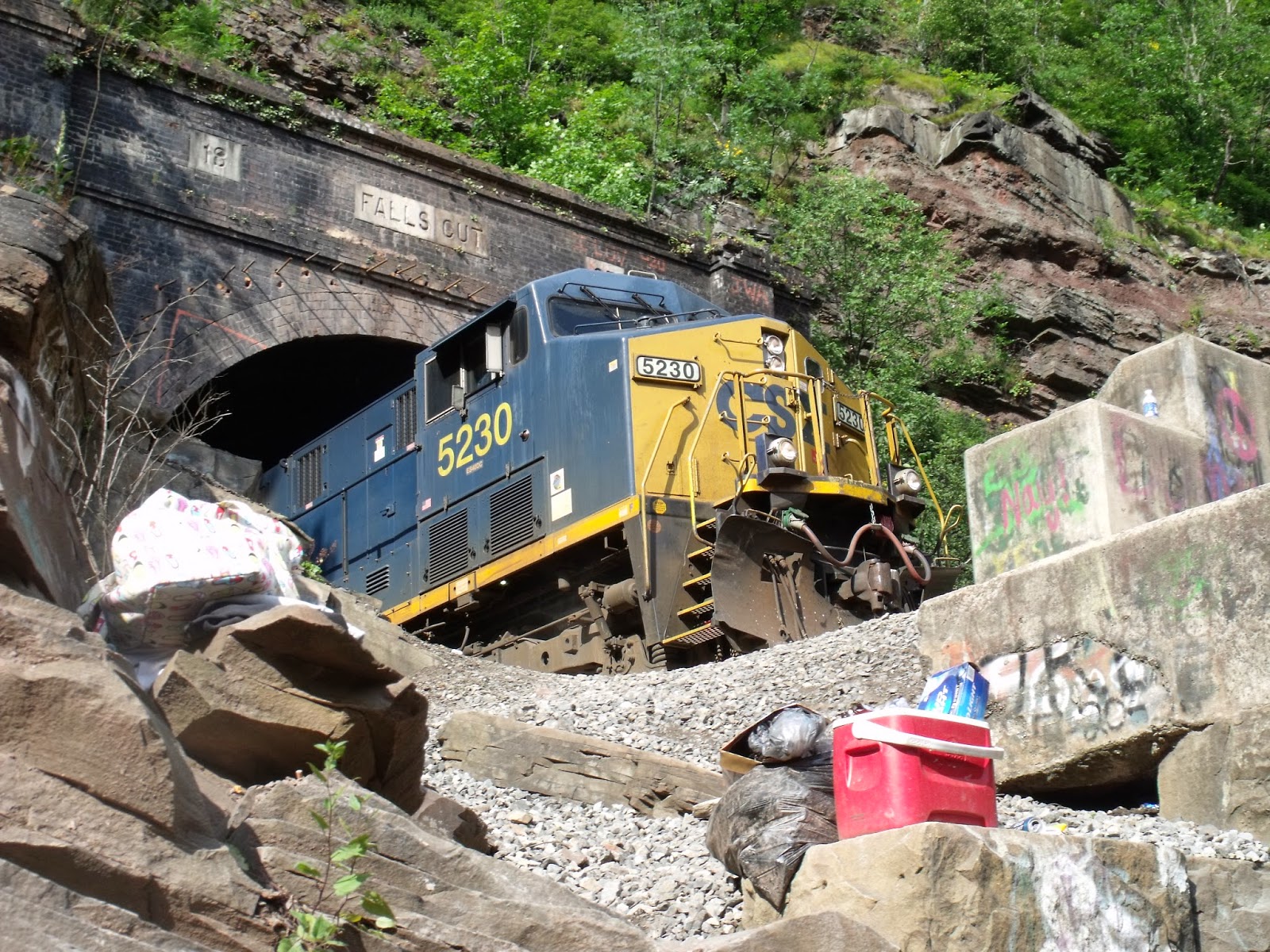
Falls Cut - Fair Hope PA

     
View of the Tunnel From Below the Tracks
     Growing up in a rural community in the summer there are plenty of things to do outside. One of my past times as a teenager was to go cliff jumping and swimming in the various quarries and lakes. In south-eastern Somerset County Pennsylvania, there is the small town of Fair Hope which is home
to a swimming hole. Fair Hope is mainly known, if at all, by its history of making bricks and being along the Historic B&O railroad. The town has been slowly fading away since the industrial revolution like many others in the rural parts of Pennsylvania.

      Just east of Fair Hope is a Tunnel called Falls Cut. The tunnel leads to a bridge that spans a swimming hole. The swimming hole has a nice formation of cliffs where locals and travelers like myself have gone to jump and swim in the water. Unfortunately when a few friends and I arrived it was like so many swimming holes, lined with graffiti with trash all around. It was fun however to climb the waterfall of rocks below the bridge and watch the trains pass overhead.

     Use extreme caution if you wish to visit this location. I do not recommended swimming or jumping from the cliffs.

Falls Cut Tunnel

Jumping Cliffs
Swimming Hole

Monday, June 16, 2014

Shade Church

 
Front of Shade Church

     It was more of an accident that I found Shade Church. I was actually in the area looking for Crum Cemetery, which I have blogged about earlier, and by chance came across this old church. I wrote down its location and as much information as I could then and set it aside for another time. While the weather broke for a brief period this past mid-winter, I decided to investigate into the place a little further. Brian, a friend of mine, and I packed up camera's and gear and set out to explore.

      I was unable to gather much information about Shade Church before we decided to investigate. From pictures of the front of the building I was able to tell it was a white boarded church built-in 1822 and had a cemetery across the road. Other than that, I was unable to find anything else about its history online. However, its paranormal history was more evident. Claims of ghostly apparitions dancing in the cemetery, caretakers of the church refusing to go back, and mysterious voices, sounds, and lights coming from within have made their way onto the internet.

A Look Inside
      Once we arrived to the church we parked along the road dividing the church and cemetery and started to examine the building from the outside. Stain-glass windows still remained around the building and the bell was still hanging in the tower. The building and cemetery seemed up kept. To our surprise we found the church doors open. We decided to respectfully venture further to take some photographs. Upon entering we were surprised to see all the pews in place, an alter with antique velvet chairs, a piano in the right corner and old wood burning stove. The interior was well maintained from what we could see. Only a little light came through the stain-glass leaving out vision poor. We both had an eerie feeling come over us at one point, but didn't witness any of the paranormal claims it held. Once we had our share of photos, we left the church both unexpectedly happy that we were able to enter the premises.

     On the way back home we talked and hoped to find out more history into the church and what community it once served. Hopefully we will get a chance to return when its warmer.
The Adjacent Cemetery

Monday, June 9, 2014

Frick's Lock


    Frick's Lock is a modern day ghost town located near Pottstown, PA. The land for Frick's Lock was acquired from a local farmer, John Frick, in the early 1800's. The village hosted 2 canal locks, #54 and #55, along the Schuylkill River. Like so many canal towns, it then adapted to host a railroad once the canals became obsolete. Frick's Lock would then meet its slow economic downfall after Conrail was formed in 1976.

     In the 1960's PECO, Philadelphia Electric Company, started to form a nuclear power plant across the Schuylkill river, and in 1986, before the station went online the residents of Frick's Lock had to move. Some say the residents were bought out and relocated, others say they were only given a 48 hour eviction notice. Either way, the homes were all boarded up and left standing stuck in time.

    Remains of about 10 buildings still stand in the ghost town. The oldest being a house from 1757, A barn from 1824, and the Lock tenders house built-in 1817. The property of Frick's Lock now belongs to PECO's successor the Exelon Corporation. Guided tours of the historic town occurred in 1997, 2000, 2002, and 2003. No other plans for tours have been arranged or made since.

    As of 2011, The East Conventry Twp. partnered with Exelon to preserve and protect the area. Plans to stabilized and rehabilitate the area are in progress. Due to his popularity as a ghost town, it has attracted many curious tourists and vandals. Vandalism hit its peak when arson was committed to one of the larger homes in Frick's Lock.The town can be reached by traveling about 4 miles south-east from Pottstown, PA on Rt. 724. The area is now patrolled by Exelon security staff and violators of trespassing can expect a hefty fine.

Tuesday, June 3, 2014

The Lost Children of the Alleghenys


      In April of 1856, Samuel Cox was having a string of bad luck hunting for food. This was not Samuel's first run with bad luck and it seemed to follow him and his family. Samuel and his wife were married in Johnstown Pennsylvania and soon headed west to the state of Indiana looking for prosperity. The Cox family grew to include two young boys, George and Joseph, but the family fell ill to malaria which was very prevalent in Indiana at the time. The family battled the sickness for months. Finally the family was well again and made a journey back to Pennsylvania to get away from the disease. The Cox family then settled in Spruce Hollow which is located a few miles from present day Pavia.

      On the foggy morning of April 24th 1856, Samuel again went out to hunt for his family. Again he came home short-handed and disheartened. While at home eating a meager meal, the family dog began to bark and run out of the house. Samuel jumped up with his gun and chased after the dog. Once Samuel caught up with the dog it had treed a squirrel. After getting the squirrel Samuel returned home to find his wife in tears and frantic. He had only been gone for an hour and a half but his two boys were missing. Mrs. Cox thought the boys had followed their dad. Samuel was unaware the boys had followed him and had greatly outran them in the fog. Samuel tried looking can calling for the boys all day without luck, and the fog just became heavier and heavier throughout the day.

      The Next day, a small band of searchers began looking for the two boys without luck. The search party grew over the next week to include over 1000 volunteers from 50 miles away who had heard the tragic story by word of mouth. The search was unfruitful, and rumors started to spread that Samuel and his wife had killed the boys. The accusations went so far, that the Cox family's floor boards were torn up looking for the boys.

      Neighbors of the Cox family started to implement other means to find the boys after their search had come up empty-handed. The belief in magic and witchcraft was very prevalent in the late 1800's. Many of the German pow-wow doctors, not to be confused with indian powwows, blended christianity with old world religion to heal the spirit as well at the body. A local man was said to have the ability to find anything by only using a peach tree limb in the shape of a “Y”. The man was known for finding underground water and lost objects. His search with the peach tree limb proved unsuccessful. The search party went as far as to send for the help of a known witch from Somerset county. She basically duped the men out of money and stumbled in the woods a few days and was unable to find the boys either.

      Things were looking very grim for the Cox family; however, a man eventually came forward with some information about the boys location. Jacob Dibert had a very vivid and weird dream the night after the boys disappearance. Jacob had no idea of the tragedy when he had his dream. While sleeping, Jacob dreamt that he wa walking a path through the woods when he came across a dead deer. Walking further he walked past a childs shoe, and eventually to a small bunch of fallen birch trees. Once he crossed over the tress, he saw two young boys huddled under a fallen tree in the ravine. Jacob had the dream the next two nights, then finally told his wife. After telling his wife, she told him to tell his brother-in-law Harrison Whysong. Harrison immediately recognised the details of the dream and knew of the boys disappearance. They went searching for the boys on May 8th 1856, following the clues of Jacobs dream and found the two boys dead in the ravine of starvation and exposure.

      Many have speculated that Jacob and Harrison had something to do with the deaths to know exactly where they were to be found. Others who are more open to the supernatural believe Jacob's dream was true. Jacob and Harrison were never prosecuted for the two boys death. In 1906, donations were collected to put up a memorial for the lost children's 50th anniversary. In 1910, a monument was raised and still stands today. Today the monument is in a roofed building in the ravine where the children were found and a plaque gives a brief history of the boys tragic story. The area is still rumored to be haunted by the two Cox boys. Many say you can still hear them crying and peaking around the trees.


 The Monument is located near Pavia PA. Turning off to Blue Knob Road, you will come to Monument Road. A short drive back will lead to a sign pointing the way to the monument and a parking area. The boys themselves are buried in Mt. Union Cemetery.


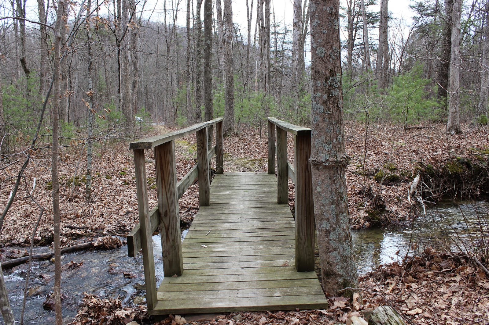
Path and Bridge Leading to the Cox Monument


Tuesday, May 27, 2014

Ghost Town : Concrete City


     A little drive south-west from Wilkes-Barre PA is the town of Nanticoke. South from there is a novel display of the coal industries innovation and grandeur in the early 20th centery. The Delaware, Lackwanna, and Western Railroad (DL&W) built a whole town out of concrete to house the coal
miners of the near by colliery. At that time nearly 34% of people lived in some sort of housing owned by the companies they were employed at. Company housing was usually very basic and almost primitive. However, the DL&W had a plan to build modest housing for the minors but keep the building expenses low. This plan


      In 1911, ground was broke to start construction of 20 double homes made of concrete. The homes were arranged in a rectangular way with a central park. Each residence accommodated 2 families with 7 rooms and 4 bedrooms on the 2nd floor. An outhouse and coal bin were placed outside each home. Total cost for the building was approximately $2500 and cost the families $8.00 to rent each month. Once completed the housing development was called “The Garden City of the Anthracite Region”. Homes constantly though the years won garden shows and all was well for the first few years.

      Concrete City started its decline about 2 years after building. The homes had an ongoing issue with condensation inside and out. Inside the plastered walls would leak and need repaired every other year. Outside the paint would need scrapped and repainted every few years. A few more years later the central swimming pool in the park was filled in due to a boy drowning. The Concrete buildings continued to be rented for 11 years. In 1924 township laws required that the Concrete City install a sewer system at the cost of $200,000. The DL&W could not justify the cost and demolishing was scheduled. Over 100 sticks of dynamite were used to level the city. However, the Concrete was well reinforced and barely scratched the buildings.

      Over the years after the failed demolishing, the concrete city was used by the Luzerne Co. Fire company to do test fires and training exercises. The filled in swimming pool was used to burn off chemicals in a controlled fashion. In 1992, the historical area was bought and saved and registered as a historical landmark. The bombed out, burned, and vandalized buildings still remain a shell of the dreams of the coal industry era. No new plans have been made to restore its once award winning gardens. Mother nature continues to slowly take back its land. If you visit the city, use caution.

      The buildings still stand but are dangerous to enter. My trip a few years ago was well worth it. It was amazing to see the concrete giants still standing after all they had been through. When we arrived local paintball players were having a skirmish. We explored the buildings and found they had a basement, and 2 floors. Many of the buildings had holes from the dynamite, a few still had charred marks from the controlled fires. All the buildings were marked with graffiti. The central swimming pool was grown in with vegetation and junk.

      To get to the remains of Concrete City, take Middle Rd which runs south of Nanticoke. Make a left onto Epsy Street then another left onto Front Street. A few yards ahead will be a Historical Marker and a Path leading back to the abandon town. Here are the GPS coordinates 41°11'20.68"N , 75°58'34.34"W.

Tuesday, May 20, 2014

Pulpit Rocks


   While driving through Huntingdon county, I came across an outcropping of rocks along Alexandria Pike Road. Like so many of my blogs, I had just stubble upon another piece of history. It surprises me how many things are almost in my backyard, but I have went through a great part of my life never knowing they were there. When I approached the rocks on the side of the road, a plaque gave me just about all the information I needed on the area. Pulpit Rocks, as its named, is part of a rock formation nearly 390 million years old. The pillars of sandstone were part of the first geological survey of Pennsylvania which was published in 1858. It is now owned by Juniata College and heirs of the Eisenberg family. The college uses it as a teaching tool for geology. It is also used for rock rappelling and training.  


Monday, May 12, 2014

Lost Resting Places: Mcquire Cemetery

     Sometimes I find very interesting things while Geocaching. For those of you who don't know what geocaching is, it is basically a high-tech scavenger hunt. People use GPS receivers to hide boxes and various other things and other people use their GPS to find them. More than likely there is a geocache hidden only a few miles from you live. Anyway, while geocaching a few months ago, I came across another almost forgotten cemetery in Huntingdon County called Mcquire Cemetery.

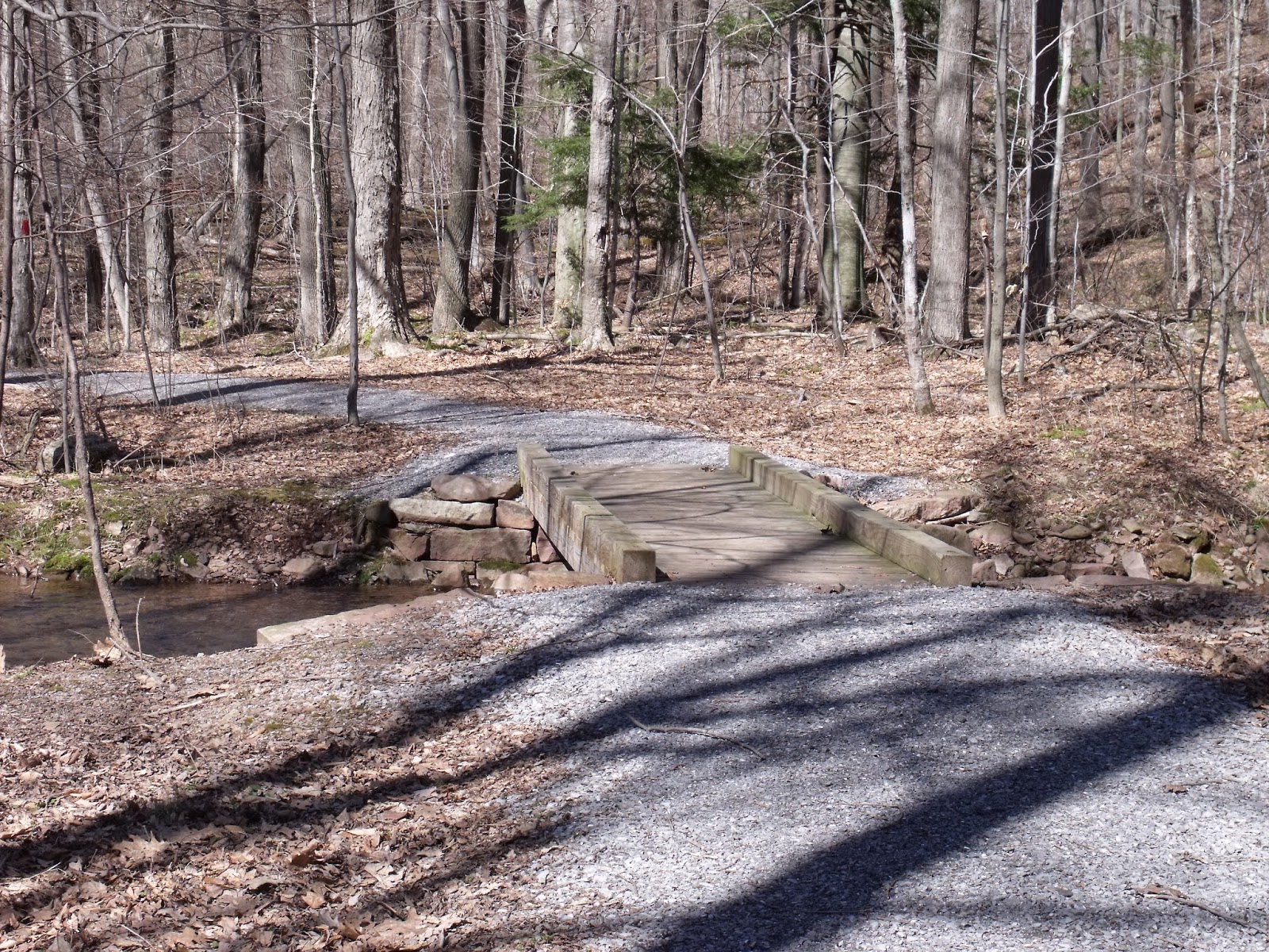
      Mcquire Cemetery now resides in RothRock State Forest. A short ride on the game land roads, a sign marks the trail leading up to the cemetery. Hiking back the trail you first come across a small bridge over a creek and then make your way up a hill. The cemetery is to the right of the trail and surrounded by a newer wooden fence. All that remains of the cemetery is multiple fieldstones; their names lost to history.

      Upon my arrival to the cemetery, I paid my respects to the early pioneers and began to wonder. How many more small cemeteries also could be out there in the remote parts of Pennsylvania? And how many of them have been forgotten or lost. Mcquire Cemetery gave me a peaceful feeling while being there. Once I had taken a few pictures, we found the geocache near the cemetery and made our way back to our vehicle. Once home from our day of exploring, I began to research more in-depth about the Mcquire Cemetery.

      To my surprise, the area of the cemetery was once host to an indian massacre. Indian raids were a frequent thing during the time the cemetery was established in the late 1790s. There were two families involved in the massacre, Mcquire and Donnelly. Both families had casualties and a few escaped. Legend tells of Jane Mcquire being in a near by field with the cattle when the raid took place. Once the Indians had found her, they grabbed her by the dress just as she grabbed the tail of one of the cattle and was dragged off to safety. It may be hard to believe, but regardless it has helped this encounter to service many generations.

      Directions to this location from Pettersburg PA are as follows. Head west on Rt. 305 (Juniata Valley Pike) and take a right onto Barree Rd. Follow it along the Little Juniata River until you can make a right onto Teaberry Hollow Road. A short drive will then take you to Mcquire Road which will lead to the sign marking the trail.

Tuesday, May 6, 2014

1000 Steps Hiking Trail

   
  Imagine having to commute each day for work by climbing 1000 steps. In the early 20th century workers at the Jack's Mountain quarry had to make their way up the mountain side daily whether sun, rain, or even snow. At first the only way up the mountain was to follow the switch back railroad lines that curved up the mountain side. In the 1930s workers constructed an easier path up the mountain, straight up. Thus the 1000 Steps hiking trail was born and is still available to climb today.

      Just west of Mt. Union Pennsylvania lies a part of the Allegheny mountains know as Jack's Mountain. The area was quarried for sand and rock to help build heat proof furnaces for the booming steel industry. At the base of the mountain, known as Jack's narrows, Route 22 runs along the Juniatta river. This essential pass was also home at one time or another to other great transportation means such as the PA Turnpike, PA canal, and the PA Railroad.

      1000 Steps can be enjoyed by anyone who wishes to test their fitness. A small parking area sits along Route 22 near the Mapleton Gas Station west of Mt. Union PA. The trail head is a short walk from the parking area near the guide rail. Water can be seen flowing off the mountain along the trail. The steps are made from the rocks that litter the mountain. Some of the rocks even have fossils to discover along the way. At the top of 1000 steps, 1030 to be exact, if you take the trail to the left you will come across an old building. Continuing left and a short distance up the mountain the best lookout is marked with an old rail. A breath taking view awaits anytime of the year. However, my personal favorite time is in the autumn watching the trains follow the Juniata river into Mapleton. If you decide to take on this well worth challenge, my best advise is to take your time and pack some water.