Tuesday, May 27, 2014

Ghost Town : Concrete City


     A little drive south-west from Wilkes-Barre PA is the town of Nanticoke. South from there is a novel display of the coal industries innovation and grandeur in the early 20th centery. The Delaware, Lackwanna, and Western Railroad (DL&W) built a whole town out of concrete to house the coal
miners of the near by colliery. At that time nearly 34% of people lived in some sort of housing owned by the companies they were employed at. Company housing was usually very basic and almost primitive. However, the DL&W had a plan to build modest housing for the minors but keep the building expenses low. This plan


      In 1911, ground was broke to start construction of 20 double homes made of concrete. The homes were arranged in a rectangular way with a central park. Each residence accommodated 2 families with 7 rooms and 4 bedrooms on the 2nd floor. An outhouse and coal bin were placed outside each home. Total cost for the building was approximately $2500 and cost the families $8.00 to rent each month. Once completed the housing development was called “The Garden City of the Anthracite Region”. Homes constantly though the years won garden shows and all was well for the first few years.

      Concrete City started its decline about 2 years after building. The homes had an ongoing issue with condensation inside and out. Inside the plastered walls would leak and need repaired every other year. Outside the paint would need scrapped and repainted every few years. A few more years later the central swimming pool in the park was filled in due to a boy drowning. The Concrete buildings continued to be rented for 11 years. In 1924 township laws required that the Concrete City install a sewer system at the cost of $200,000. The DL&W could not justify the cost and demolishing was scheduled. Over 100 sticks of dynamite were used to level the city. However, the Concrete was well reinforced and barely scratched the buildings.

      Over the years after the failed demolishing, the concrete city was used by the Luzerne Co. Fire company to do test fires and training exercises. The filled in swimming pool was used to burn off chemicals in a controlled fashion. In 1992, the historical area was bought and saved and registered as a historical landmark. The bombed out, burned, and vandalized buildings still remain a shell of the dreams of the coal industry era. No new plans have been made to restore its once award winning gardens. Mother nature continues to slowly take back its land. If you visit the city, use caution.

      The buildings still stand but are dangerous to enter. My trip a few years ago was well worth it. It was amazing to see the concrete giants still standing after all they had been through. When we arrived local paintball players were having a skirmish. We explored the buildings and found they had a basement, and 2 floors. Many of the buildings had holes from the dynamite, a few still had charred marks from the controlled fires. All the buildings were marked with graffiti. The central swimming pool was grown in with vegetation and junk.

      To get to the remains of Concrete City, take Middle Rd which runs south of Nanticoke. Make a left onto Epsy Street then another left onto Front Street. A few yards ahead will be a Historical Marker and a Path leading back to the abandon town. Here are the GPS coordinates 41°11'20.68"N , 75°58'34.34"W.

Tuesday, May 20, 2014

Pulpit Rocks


   While driving through Huntingdon county, I came across an outcropping of rocks along Alexandria Pike Road. Like so many of my blogs, I had just stubble upon another piece of history. It surprises me how many things are almost in my backyard, but I have went through a great part of my life never knowing they were there. When I approached the rocks on the side of the road, a plaque gave me just about all the information I needed on the area. Pulpit Rocks, as its named, is part of a rock formation nearly 390 million years old. The pillars of sandstone were part of the first geological survey of Pennsylvania which was published in 1858. It is now owned by Juniata College and heirs of the Eisenberg family. The college uses it as a teaching tool for geology. It is also used for rock rappelling and training.  


Monday, May 12, 2014

Lost Resting Places: Mcquire Cemetery

     Sometimes I find very interesting things while Geocaching. For those of you who don't know what geocaching is, it is basically a high-tech scavenger hunt. People use GPS receivers to hide boxes and various other things and other people use their GPS to find them. More than likely there is a geocache hidden only a few miles from you live. Anyway, while geocaching a few months ago, I came across another almost forgotten cemetery in Huntingdon County called Mcquire Cemetery.

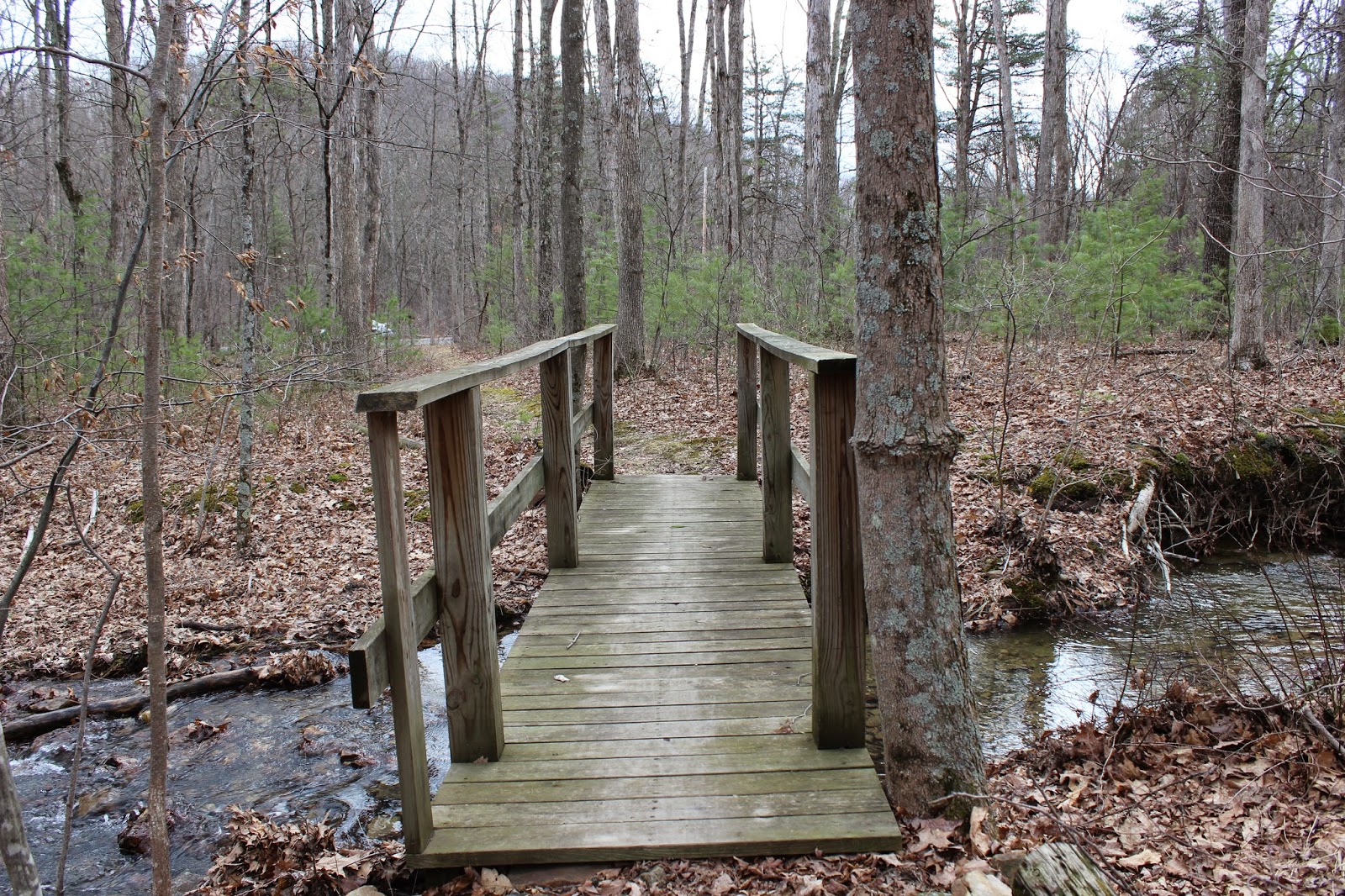
      Mcquire Cemetery now resides in RothRock State Forest. A short ride on the game land roads, a sign marks the trail leading up to the cemetery. Hiking back the trail you first come across a small bridge over a creek and then make your way up a hill. The cemetery is to the right of the trail and surrounded by a newer wooden fence. All that remains of the cemetery is multiple fieldstones; their names lost to history.

      Upon my arrival to the cemetery, I paid my respects to the early pioneers and began to wonder. How many more small cemeteries also could be out there in the remote parts of Pennsylvania? And how many of them have been forgotten or lost. Mcquire Cemetery gave me a peaceful feeling while being there. Once I had taken a few pictures, we found the geocache near the cemetery and made our way back to our vehicle. Once home from our day of exploring, I began to research more in-depth about the Mcquire Cemetery.

      To my surprise, the area of the cemetery was once host to an indian massacre. Indian raids were a frequent thing during the time the cemetery was established in the late 1790s. There were two families involved in the massacre, Mcquire and Donnelly. Both families had casualties and a few escaped. Legend tells of Jane Mcquire being in a near by field with the cattle when the raid took place. Once the Indians had found her, they grabbed her by the dress just as she grabbed the tail of one of the cattle and was dragged off to safety. It may be hard to believe, but regardless it has helped this encounter to service many generations.

      Directions to this location from Pettersburg PA are as follows. Head west on Rt. 305 (Juniata Valley Pike) and take a right onto Barree Rd. Follow it along the Little Juniata River until you can make a right onto Teaberry Hollow Road. A short drive will then take you to Mcquire Road which will lead to the sign marking the trail.

Tuesday, May 6, 2014

1000 Steps Hiking Trail

   
  Imagine having to commute each day for work by climbing 1000 steps. In the early 20th century workers at the Jack's Mountain quarry had to make their way up the mountain side daily whether sun, rain, or even snow. At first the only way up the mountain was to follow the switch back railroad lines that curved up the mountain side. In the 1930s workers constructed an easier path up the mountain, straight up. Thus the 1000 Steps hiking trail was born and is still available to climb today.

      Just west of Mt. Union Pennsylvania lies a part of the Allegheny mountains know as Jack's Mountain. The area was quarried for sand and rock to help build heat proof furnaces for the booming steel industry. At the base of the mountain, known as Jack's narrows, Route 22 runs along the Juniatta river. This essential pass was also home at one time or another to other great transportation means such as the PA Turnpike, PA canal, and the PA Railroad.

      1000 Steps can be enjoyed by anyone who wishes to test their fitness. A small parking area sits along Route 22 near the Mapleton Gas Station west of Mt. Union PA. The trail head is a short walk from the parking area near the guide rail. Water can be seen flowing off the mountain along the trail. The steps are made from the rocks that litter the mountain. Some of the rocks even have fossils to discover along the way. At the top of 1000 steps, 1030 to be exact, if you take the trail to the left you will come across an old building. Continuing left and a short distance up the mountain the best lookout is marked with an old rail. A breath taking view awaits anytime of the year. However, my personal favorite time is in the autumn watching the trains follow the Juniata river into Mapleton. If you decide to take on this well worth challenge, my best advise is to take your time and pack some water.


Monday, April 28, 2014

Swamp Church & The Weeping Spirit

 
Bethesda Church aka Swamp Church
     In a secluded area of Centre county on an old dirt road, sits an abandon church with a lot of history. Bethesda Church was one of the first churches in the area and was founded in 1855. More commonly the church is known by its nick-name “Swamp Church” due to the proximity to the marshy land of Penns Creek. The church had been in service for more than 5 generations and even held the wedding of the current owners Hans and Shirley Sennholz. The last public service as held in 1961. It now sits dormant along Swamp Church Rd. a short distance from Penns Cave. Occasionally the doors of the church open for private events and weddings.

Side view of Swamp Church
      A few local legends circulate around Swamp Church, such as, phantom bells ringing, and ghostly apparitions wondering the property. One story has seem to stick around and was first documented by witnesses in the 1880's. On a chilly night in the beginning of May, Mr. and Mrs. Schultz were relaxing on there porch before bed. At first Mr. Schultz thought he saw a faint outline of a person walking along Swamp Church Rd. but dismissed it with a second glance. The couple was about to go into their home when they both saw a women wearing a white dress carrying something. The women in white then approached the stairs of Bethesda Church. Her distant weeping alarmed Mr. Schultz and he went to investigate and offer help. As Mr. Schultz got closer he was able to make out the spirit saying “William”. The account of what happened next is split in two. One surviving account tells that when the women approached the church, there was a baby in her hands. She pleaded and cried to be let into the church but the doors would not open and she faded away. Another account states once she arrived at the church doors, they flung open and the gas lanterns inside burst with light. The weeping woman then proceeded to walk down the rows of pews showing her child and then faded away once she reached the pulpit.

      Most accounts of the story agree upon the history behind the weeping woman. She was to be married to a solider named William. He was a solider during the 1860's in the Civil War. William and his bride to be conceived a child the night before he left for duty. William, or Will as he is sometimes mentioned, was later killed in battle with others in the 148th Company D regiment of Pennsylvania in 1862 and never returned to her. The congregation rejected her for baring a child out of wed lock and shunned her. The legend claims that her restless spirits still longs for the congregations acceptance. Legend has it, that on the night of May 3rd when conditions are right you can still see her walking along the road and trying to win the churches favor.

     I would like to end by just reminding my readers that the church and its grounds are privately owned and please be respectful.

Monday, April 21, 2014

Keller Church & The Dean Family Massacre

     
Keller Church
     Right off of Rt. 22 on Fox Run Road there is a small church and cemetery with an almost forgotten past. Keller Church is in Catherine township on top of a hill, and has not held a service in years. The Church was founded in 1846 and was the prominent burial ground for the Keller family and other families in the Canoe Valley. The church is made of brick on a limestone foundation. The cemetery is adjacent on the hill-side with tall pine trees over the graves. A little history also lies with one of the occupants of the cemetery, Matthew Dean. 
 
      Living near Keller church for a part of my life, I stumbled across this piece of history while taking photographs of historical places in my area. I found a memorial to the Dean family which reads,"Massacred by Indians October 1780." I had forgotten about the memorial for a few years; however, Recently I had revisited this site and look deeper into its history.

      Matthew Dean was of Irish decent and made his home approximately 3 miles southwest of Waterstreet Pennsylvania. In the late 1700's while the Revolutionary War was taking place in the eastern part of Pennsylvania, a lot of the rural parts of the state were still faced with the remnants of the French and Indian War. In the autumn of 1780, the wife and three children of Matthew Dean were killed by Indians at their home in what is now Catherine township. Some accounts of the massacre say the family was burned in the home while others only say they were scalped and murdered. Most of the accounts tend to agree that Mr. Dean and his oldest children were at work in the fields when the raid happened on the homestead. Mr. Dean and his son found the remains of his family and they were later buried in Keller cemetery. Matthew Dean later died in April of 1781 and was buried in Hart's log Cemetery near Alexandria PA.

      This is just one of the many accounts of Indian raids and massacres that happened in central Pennsylvania. Some accounts have been lost to history; were as, others hold ground in our world by small memorials or accounts passed from generations. I hope to continue to investigate these incidents and keep them alive for another generation.

Monday, April 14, 2014

Lost Resting Places: Brua Family Cemetery


Brua Cemetery
      I had recently wrote a blog about the Bura Family of Franktown and the remnants of their mansion and orchard. Upon researching the families property I found out they had a family cemetery but failed to find the location. Finally, I have was able to track down this elusive cemetery. The grave yard sits a short walk from the foundations of the Brua home. You can also get to this cemetery by parking along Locke Mt. Road and walking up a hill to a grove of pine trees. Not many monuments are left, and many of the markers are fieldstones. The cemetery is in disarray but at one time was the main cemetery for Frankstown until the Geeseytown Cemetery was built. As always, if you plan to visit this resting place be respectful.